Unlock the True Power of your Drone Inspections

By Imagine Technologies Group.
How to go beyond the images and intelligently use all of your collected drone visual data.
Drone-based inspections are becoming increasingly common. It isn’t a stretch to imagine why either, since drone inspections increase worker safety, capture data faster and more accurately and help reduce the cost of inspections.
When combined with Beyond Visual Line of Site (BVLOS) capability, drone-based inspections become an even more attractive option, with organizations being allowed to make more frequent inspections in a shorter amount of time.
Thus, Unmanned Aerial Vehicle (UAV) inspections will continue to expand for all of the benefits they offer contractors. However, these applications are only accessing a fraction of the possible benefits of this technology.
In Imagine Technologies Group’s white paper they uncover how to optimize the highly accurate drone roof survey data Optelos offers so that you can improve roof assessments. They cover:
1 - How to best manage your collected visual data.
2 - How to operationalize that data.
3 - The best data collection practices.
4 - The best asset analysis practices.
5 – Putting all the data together.
How to go beyond pictures to drive better decisions
Drone-based inspections offer a lot more data than just pictures; they can offer insights like LiDAR, thermal and methane detection. You can use this data to make sustainable improvements and breakthroughs and get a maximum return on your investment in drone programs. Stop wasting your data and start integrating 2D and 3D models and Digital Twins into a comprehensive view of the asset so as to provide contextual relationships with the visual data.
So how do you generate the highest return on investment?
-
Intelligently store and manage massive datasets. You have to create a single source of truth to allow data to be processed, correlated, easily accessed and shared across the organization. This means you need to have software that can manage all the data associated with your UAV program in one place.
-
Integrated data visualization. It is critical to provide a way to visualize and act on all this data, be it complex 3D models, maps, panoramas or videos. Provide the necessary visualization and analysis so that all stakeholders can access and utilize it to drive real outcomes. Doing so not only eliminates the need for disparate systems but uncovers the real power of the data. Making this information accessible and understandable is key to using the data to your advantage.
-
Operationalize this data. Ideally, with this data you will create a workflow that provides the right data to the right person at the right time and place so that rapid trouble resolution can occur.
Achieving optimal results in five steps
Once a robust data management system is in place, you can focus on perfecting your best practices so you can guarantee optimal results and repeatability. Following these steps will ensure optimal results for whatever your specific use case might be.
Step 1: Identify your objectives.
Too often are drone-based programs implemented without identifying the specific improvements companies are trying to achieve. However, this is an important step, since every asset type or targeted improvement requires specificity of purpose to achieve optimal results.
Step 2: Select the corresponding drone sensor type and data collection method.
“One size fits all” does not exist in data collection. This is why having an objective is so necessary, because images need to be collected in a manner consistent with the desired outcome and asset type being inspected. How you collect the data is as important how you analyze it.
Step 3: Utilize the data type best suited for the objective.
Using data that will provide the most meaningful results is the secret to achieving a desired inspection outcome. Different data types will be better suited for particular types of analysis. Determine the data formats such as images, videos, thermal, orthomosaic maps, or 3D models that best align with your inspection goals.
Step 4: Employ the correct data analysis methods.
Once the images have been collected using the sensor best suited for that asset, there are a variety of analysis methods you can use to better understand this data. You will want to employ the right data analysis methods and reality models to best identify desired asset conditions.
Step 5: Integrate dispatch or trouble ticketing.
Improvements will not be fully realized until this new visual data and the inspection results become a part of an end-to-end workflow. Use the outcomes from the analysis to equip field personnel to rapidly mitigate issues. This means employing a system that allows the pertinent inspection data, geolocation information and any other important repair and asset data to be associated with the specific dispatch event or generated trouble ticket.
Conclusion
If you want to get the most out of your UAV program and turn the collected data into actionable insights, you need a robust data management platform that will help you reach your inspection needs.
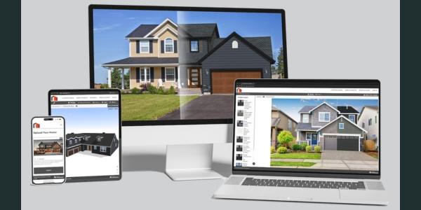
Optelos’ visual inspection platform and drone captured data produces high-resolution images and 2D and 3D models for detailed roof assessments, providing unique insights into the conditions of their roofs, as well as assisting in the planning and inventory management of new roofing construction and repair projects.
A solution is delivered through Imagine Technologies Group (ITG), born out of a desire to integrate visual data with existing rooftop data to help digitally transform the way rooftop assessments/takeoffs are performed and deliver even greater long-term results.
Learn more about the Imagine Technologies Group in their RoofersCoffeeShop® Directories or visit www.imaginetechnologiesgroup.com.


Comments
Leave a Reply
Have an account? Login to leave a comment!
Sign In