Three Things your Aerial Imagery Company Must Deliver.
By Nearmap.
It’s about more than just having the aerial image, it’s about having one that will help you do your job better and more accurately.
High-resolution maps improve roofing estimate speed and accuracy, reduce the number of costly site visits, and help to rapidly scale your business. But you want to be sure that the images you are relying on for your intelligence are current, high-resolution and provide you a clear view of the building.
1 - When was the photo taken?
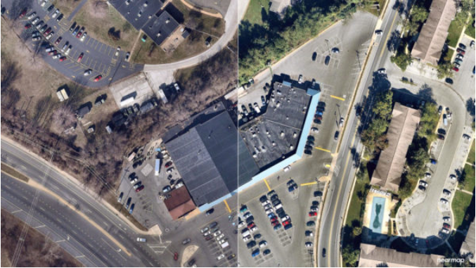
Many aerial image providers update their imagery every one to two years. A lot can change in 12 months. Building could experience additions or have changes caused by damage from storms or other bad weather. It’s imperative to make sure you know how current the image is before you use it for estimating, evaluating and job planning.
2 – What is the resolution of the image?
Resolution matters. Especially if you are using the image to extract measurements. Resolution is typically defined in inches per pixel. An image is made up of tiny pixels or squares that are pieced together to form a complete photo. Most satellite photos are 12 inches per pixel. That means that if you are drawing over that image to extract measurements and you are off by just one pixel, your measurements at 12 inches off! Be aware of the resolution of the images you are choosing.
3 – Does the image allow you to see the entire structure?
Images of buildings taken from above can easily be obstructed by leaves on trees. Nearmap typically captures leaf-off imagery each year, catching nature’s narrow windows before leaves appear in the spring, and often just before winter snows.
We’ve set up this gallery so you can see for yourself the clarity, resolution and quality of our leaf off images. We’ll even send you an image for free so you can try it. Request your free image today.


-2025-xtv-mls-tour-2.png)






Comments
Leave a Reply
Have an account? Login to leave a comment!
Sign In