Gaining an Edge in Roofing with HD Aerial Imagery
The most successful commercial and residential roofing contractors are outpacing their competitors in lead generation, estimating, quoting, and installation.
by Tim Frank.
A critical piece of technology allowing them to achieve these goals is high-resolution aerial imagery. Nearmap recently exhibited at the 2018 International Roofing Expo (IRE) in New Orleans, where we spoke with roofers about the challenges they face, and how aerial photography is addressing these challenges.
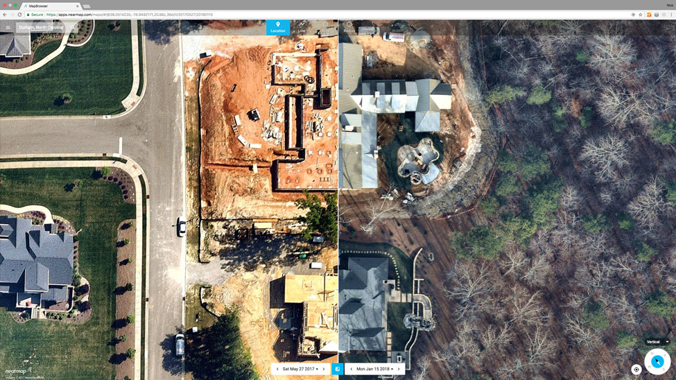
One of the common themes we heard at IRE 2018 is the amount of time and money roofers spend trying to generate new business. Many still use traditional marketing tactics, such as sending direct mail, driving neighborhoods or business parks to hand out cards, or relying on word-of-mouth referrals. While these tactics yield occasional results, they’re inefficient and involve a significant investment of time and money. Many were surprised to see that current, high-resolution aerial imagery from Nearmap allows them to precisely identify and target roofs that show wear, blow-off, storm damage, pooling, grease spills or other issues – all instantly accessible from MapBrowser. More importantly, they quickly realized the value of being able to view, download, and include HD aerial photos of properties in their estimates and quotes. The visual detail evident in aerial maps provide confidence with consumers. They quickly realize the roofing company has done its homework which instantly translates into a comfort level that work completed will be equally as impressive.
Another challenge we heard from attendees is the time and cost of estimating jobs. Some contractors measure and estimate jobs on-site, only to discover that a prospective customer has chosen another provider. Some try to address this inefficiency by using free satellite images or purchasing pre-built roof reports. In both cases roofers should be cautious, and research the quality and date of the imagery before purchasing. Even the latest satellite images are low resolution, often outdated, and don’t provide options to view a property during “leaf off” seasons. Similarly, roof reports may include imagery that is years old. Rather than spending a lot of money on roof reports only to find out you can’t use some of them, roofers are turning to instantly accessible aerial imagery as a way to identity properties. That way, they can optimize the number of reports ordered.
In contrast, Nearmap provides roofers with a solution that’s both easy-to-use and consistently more current, accurate, and flexible. On the show floor at IRE 2018, our specialists demonstrated the latest version of MapBrowser, a web-based tool for searching, viewing, measuring, and exporting Nearmap’s current, high-res photomaps. Unlike other providers, Nearmap gives roofers instant access to these HD aerial maps, which are updated multiple times per year with detail several times sharper than satellite imagery. In addition, Nearmap maintains a library of historical captures, which allow roofers to see how a building has changed over time.
The excitement and feedback from those who visited our booth was extremely positive.
Many commented how Nearmap helps them overcome the challenges mentioned previously, allowing them to:
- Rapidly target and prospect new leads
- Make precise measurements
- Create high-quality quotes
- Reduce the time & costs of site visits
- Avoid worker risk
The world in which we live and operate is becoming more and more competitive every day. At the same time, innovative solutions are coming on line that provide unique advantages used to set your business apart from the competition. Instantly accessible aerial imagery – updated photographs shown in sub 3 “ detail – are one of those technologies that can be applied today to rapidly expand your business.
Learn more at www.nearmap.com.
Editor’s note: This article first appeared on the Nearmap Blog and can be viewed here.















Comments
Leave a Reply
Have an account? Login to leave a comment!
Sign In