Aerial Imagery: The Proof is in the Roof
By Tim Frank, Nearmap.
Business development can be a costly endeavor for roofers. It often involves physically visiting potential job sites, spending time taking measurements and then submitting proposals - all before contracts are signed.
This process can strain roofers’ resources, particularly when time needs to be split between generating new business and completing existing jobs. To combat this, many companies purchase roofing reports, but that can be a gamble since the quality and accuracy of such reports vary along with the costs.
Images captured by drones can be a good alternative, but this technology is hard to scale for large areas since they can’t be flown far or for long periods of time and can be a challenge for smaller firms to implement. Satellite images often are lower resolution, not offering the level of detail needed to make assessments. They’re also not updated often and don’t show details that may vary by season.
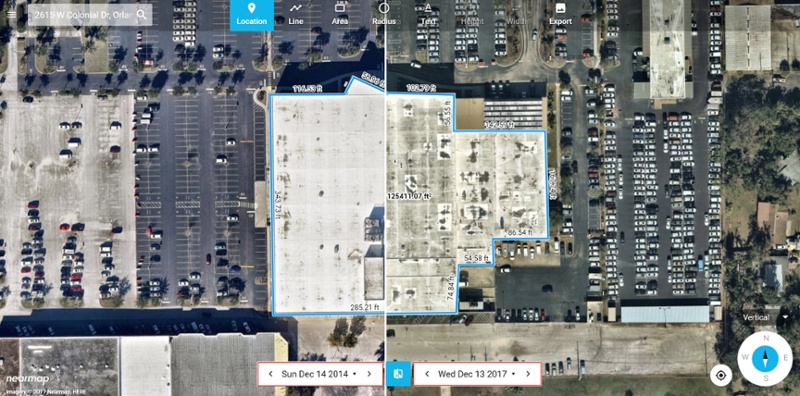
But aerial maps created at sub three-inch resolution are clear and current. They show details that satellite imagery cannot provide while also identifying the location of points on the earth’s surface within 15-centimeter horizontal accuracy for a single photo.
And because they’re created via planes and easily scaled, these maps can help improve efficiencies for roofers across the life cycle of development, from generating new business to on-going service and repairs. These phases include:
- Targeting new business
- Taking measurements
- Generating estimates and proposals
- Expediting service, maintenance and repairs
Creating efficiencies with aerial images
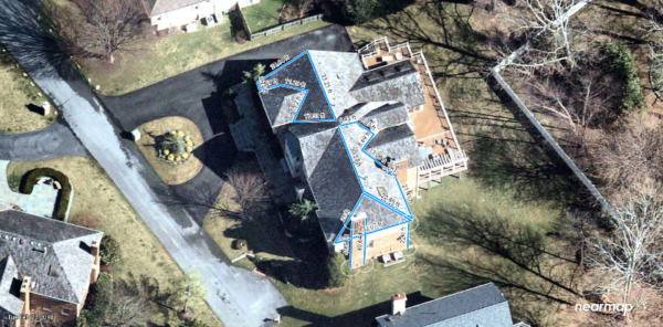
Using scans of large areas, including both residential and commercial properties, roofers can view details to determine properties that need repairs or replacements. Oblique imagery allows roofers to take measurements to generate accurate estimates and proposals without the time and expense of physically going to locations, a savings that can be passed onto customers. By being more efficient, roofers can win business faster.
Having a subscription to aerial imagery allows roofers to scan large areas quickly in high resolution. Once a potential job is found, roofers can quickly take measurements without having to spend money on individual roofing reports.
For example, Blue Raven Solar saw an eight-fold increase in their volume of estimates with an 83% reduction in costs using aerial images. Sending someone to physically inspect a location and estimate costs is approximately $300. A remote estimate costs $50 to $100, reducing costs and saving time.
High-resolution aerial imagery offers better quality, higher levels of detail and more updated pictures that are easy to integrate into design and measurement software. Roofers don’t have to worry about producing or hosting images; they simply need to log in and begin scanning.
High-resolution aerial imagery can also be beneficial for those who have multiple properties to monitor. By finding damage earlier and initiating repairs, managers can minimize damage and costs. Alerting homeowners to potential repairs can also help roofers offer more personalized service and be more competitive.
By using high-resolution aerial imagery, roofers can get ahead of the competition, provide more cost-efficient estimates and more effectively monitor properties for repairs.
See your next roofing project.
Tim Frank is senior director of marketing at Nearmap. Before joining the company in 2015, he managed global demand marketing for Symantec and several other high-tech startups for more than 15 years. He earned a bachelor’s degree in marketing communications from Brigham Young University.
Editor’s note: This article first appeared on Nearmap’s blog and can be viewed here.













Comments
Leave a Reply
Have an account? Login to leave a comment!
Sign In