EagleView Assess

Could the Waste Factor be This High? ...The Answer Might Surprise You
By EagleView. The importance of accurate measurements in the bidding process. It’s nearly impossible to climb, measure, calculate the waste factor and present an accurate bid on a home with two dodecagon (12-sided) roofs alone. That’s why one southern residential roofing contractor and his company went to EagleView ...

Introducing: JobNimbus Partnership With EagleView
JobNimbus is excited to announce their integrated partnership with EagleView, the leading measurement solution in roofing and solar. The integration increases efficiency as you can now order your EagleView directly through JobNimbus. You will then receive a complete report right back in your JobNimbus, under your client's account. The new integration ...

How This Georgia Roofing Company Made the Profits They Needed to Give Back
By EagleView. ARAC Roof it Forward utilized EagleView’s reports to create sustained growth over several years. In 2005, when the founders of ARAC Roof It Forward first opened for business, they had a vision for their company to be more than just a profitable enterprise. Instead, they also wanted their roofing business ...
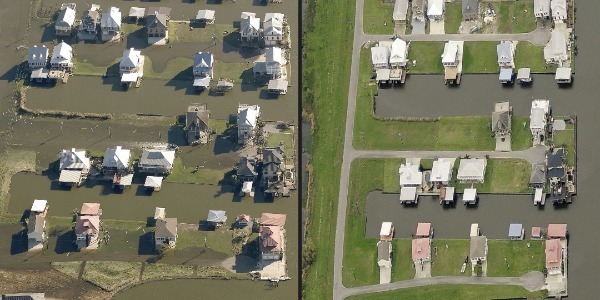
EagleView’s Ultra High-Resolution Aerial Imagery Shows Hurricane Zeta Damage
EagleView customers count on post-event imagery for recovery efforts. EagleView, a leading technology provider of aerial imagery, data analytics and GIS solutions for government, construction and insurance has received its first post-event images following Hurricane Zeta. As soon as weather conditions permitted, EagleView’s fixed-wing aircraft were in the air capturing ultra-high-resolution ...

EagleView's Ultra High-Resolution Aerial Imagery Reveals Hurricane Delta Damage
EagleView customers receive post-storm images to aid in recovery efforts. EagleView, a leading technology provider of aerial imagery, data analytics and GIS solutions for government, construction and insurance has received its first post-event images following Hurricane Delta. As soon as weather conditions permitted, EagleView's fixed-wing aircraft were in the air capturing ...

Top September Stories: Honoring Veterans and First Responders, Celebrating Hispanic Heritage Month
By Karen L. Edwards, RCS Editor. Here’s what’s trending on RoofersCoffeeShop® this past month. September's top stories covered a wide range of topics but the most read article by far was the one shared by Chris Hill at SRS Distribution honoring and remembering first responders and those whose lives were ...

Learn What Your Company Could Experience With EagleView
By EagleView. Advocate Construction shares how EagleView helped them grow from a two-man partnership to a thriving business serving six major U.S. markets. Co-owner and president of Advocate Construction, Doug Cooper, said EagleView allowed them to “scale their business.” The Illinois-based company was founded in Glendale, Illinois by Doug and his partner ...
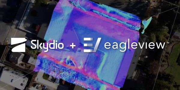
EagleView, Skydio Partner to Provide Autonomous Drone Technology for Better Property Inspections
Exclusive partnership leverages AI to boost virtual property inspection quality while lowering costs. EagleView, a leading technology provider of aerial imagery, data analytics and GIS solutions today announced an exclusive property inspection partnership with Skydio, a leading U.S drone manufacturer and world leader in autonomous flight technology for automated residential roof ...

3 Surprising Facts About This Year’s Atlantic Hurricane Season
By Trisha VanBuren, Critical Response Specialist, EagleView. As storm season records continue to break everywhere, here’s what you need to know to stay on top of the latest news. Storm season records are being broken all across the globe. The 2020 Atlantic hurricane season has already entered the double digits of named ...

EagleView Customers Receive Post-Storm Images to Aid in Recovery Efforts
EagleView imagery is an essential tool for first responders, insurance carriers and construction contractors. EagleView, a leading technology provider of aerial imagery, data analytics and GIS solutions for government, construction and insurance has received its first post-event images following Hurricane Laura. As soon as weather conditions permitted, EagleView's fixed-wing aircraft were in ...


